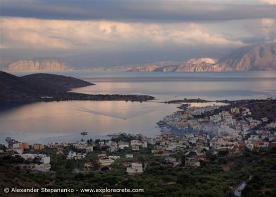
Elounda Harbour, Venetian Saltpans, Kolokytha Peninsula
Elounda welcomes you with the loveliest view in Crete
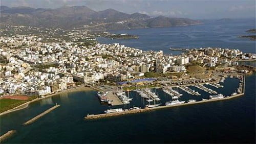
Driving from Agios Nikolaos to Elounda, the road runs uphill to the area known at Ellinika or Lenika, which has a wonderful view: a lacy coastline in every shade of blue and turquoise, the large Kolokytha Peninsula embracing Elounda Bay, and the low hills all round sloping gently to the sea.
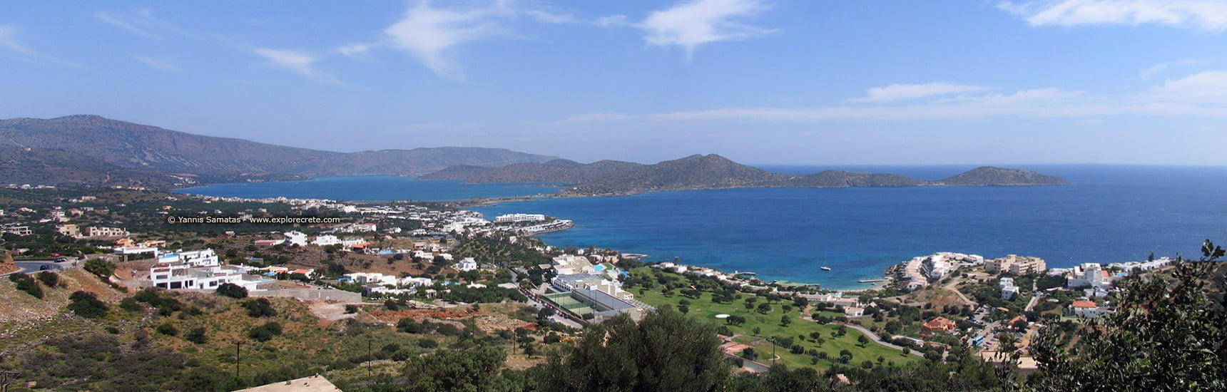
Elounda is a lucky place; if you hadn’t stopped to admire the unique view, you would have driven past the village without stopping, as the best parts can’t be seen from the road.
On entering Elounda, the picture is pretty boring: a narrow street where two cars can only just squeeze past each other, and new buildings, colourless and in no particular style of architecture.
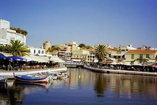
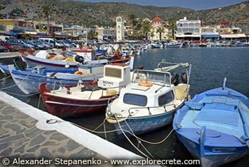
The road passes the car park in the centre of Elounda. Behind it is the picturesque little harbour with its fishing boats. Here is the main beach of Elounda and the point where the boats leave for Spinalonga.
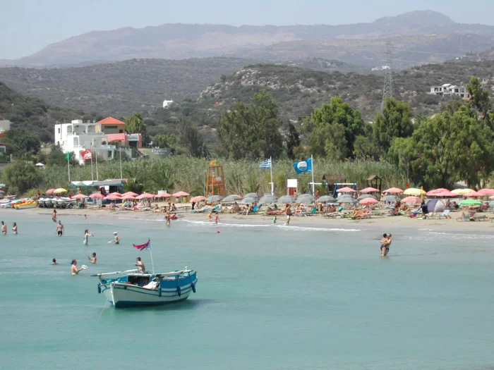
Once past the village centre, the route becomes pretty again. We drive along the shore, on a level with the aquamarine waters. The road leads to Driros beach with its pine trees lapped by the waves, and to Plaka and its beach a few kilometres further on.
The picturesque harbour of Elounda
A walk round Elounda should obviously start from its centre, the harbour. Before the luxury hotels sprang up, Elounda was just a typical fishing village, extending no further than this harbour.
The little harbour is still picturesque today. Here all the local fishing boats and other vessels seek refuge, offering typical Mediterranean sea images.
From the harbour, take the narrow coastal road southeast. Having passed the restaurants and cafes offering romantic gastronomic delights by the sea – leave these for when you get back – follow the narrow street towards the Venetian saltpans and the Kolokytha Peninsula. This is the east beach of Elounda.
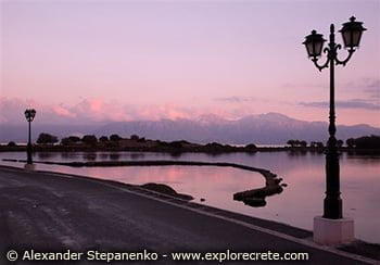
The road is only just above sea level, and the shore narrows as you walk along it until it ends in an isthmus connecting Elounda to the Kolokytha Peninsula.
At this point you cross a narrow strip of land, with the calm sea of Elounda spreading on either side of you.
The Elounda saltpans
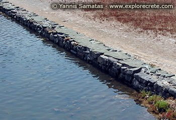
On your right hand are the Venetian saltpans. Look carefully and you will see the stone walls forming large squares.
The sea water evaporated inside the squares, leaving the salt at the bottom of the pan. The workers stood on the low walls to collect it.
From the 13th century onwards, salt from the Elounda saltpans filled the holds of Venetian trading vessels. Salt, a Venetian monopoly, was a particularly expensive commodity at the time.
Salt was so valuable that it was stored in the Mirabello Fortress in Agios Nikolaos.
The Kolokytha Peninsula
The walk doesn’t end at the end of the tarmac road. Cross the small bridge and you are now on the Kolokytha Peninsula, as it is known today. The Venetians called it Spinalonga, like the neighbouring island.
Kolokytha forms a huge breakwater, keeping the water in Elounda Bay calm. The spot where the little bridge stands is called Poros. In 1897 the French fleet, commanded by Admiral Dupurgé, dug a narrow channel to allow small vessels to enter Elounda harbour without having to sail round the Kolokytha Peninsula.
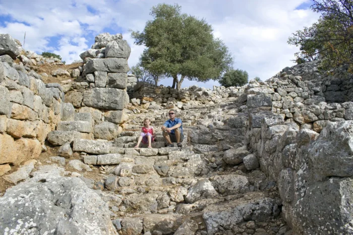
In ancient times, Poros was the site of the great and powerful city of Οlous (Olounda), which gave its name to modern Elounda.
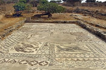
Archaeological excavations have brought to light the foundations of an Early Christian basilica of the 5th c. AD, large by the standards of the time, with an exceptional mosaic floor.
In the ruins of the basilica was found part of an ancient inscription in the Doric dialect, now on display in Agios Nikolaos Museum, referring to the end of the alliance between Olous and Rhodes.
The excavations in the Elounda area are not yet finished. They are expected to lead to finds which will shed more light on this major ancient city.
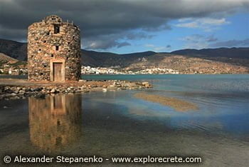
Immediately after the bridge, you will be welcomed to Kolokytha by an old windmill, one of the few signs of human intervention here.
The peninsula, which locals also refer to as “Nissi” (“Island”), is 7-8 kilometres long. It is a protected area, which is why there are hardly any buildings here.
Kolokytha is ideal for anyone who likes walking. You can cross it from end to end, or follow the footpath leading to the small beach on the inner side of the peninsula.
© explorecrete.com All Rights Reserved. Reproduction or copying without permission is prohibited.