Samaria Gorge Pictures
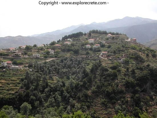
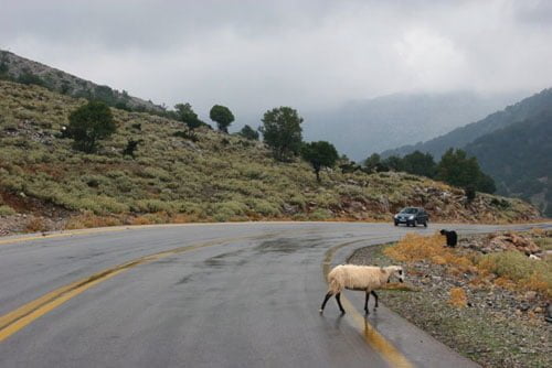
On the road from Chania to the Omalos Plateau and the Samaria Gorge, you pass through the village of Lakki, one of the prettiest villages in Crete, built in terraces on a green hill, and with a history going back to the Byzantine period. 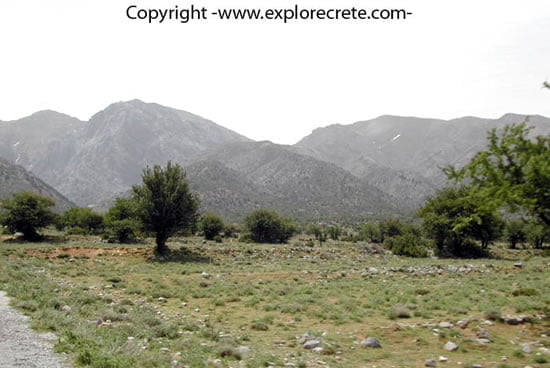
A few kilometres on we reach the Omalos Plateau, 1050 metres above sea level. On Omalos, which covers an area of 25 square kilometres, you will find restaurants and small hotels open all year round. 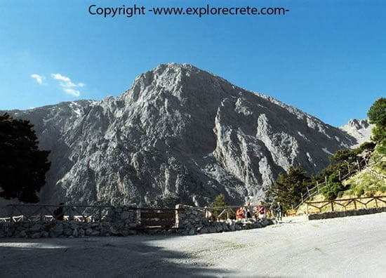
The entrance to the Samaria Gorge, or Xyloskalo (“wooden stairs”) as it is locally known. The mountain with the grey rocks is Mt Gigilos, rising 2080 metres above Samaria. Gigilos means “rotten”, and the mountain was named for its rotten rocks. 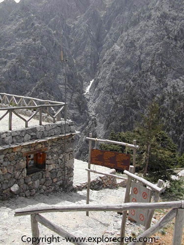
Xyloskalo is 1227 metres above sea level. Here you will buy your ticket to enter the gorge. 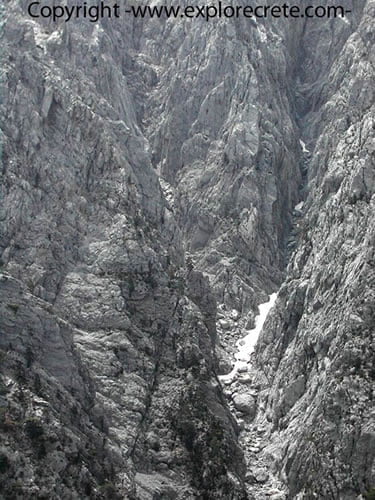
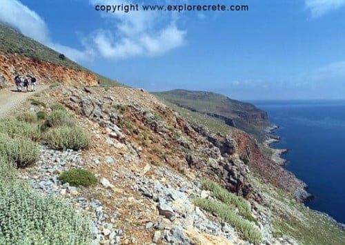
Directly opposite Xyloskalo rises the imposing Mt Gigilos with its sheer sides, where some snow may still remain in sunless crevices in June. The cliffs of Gigilos are popular with climbers even when covered with snow and ice (ice climbing). 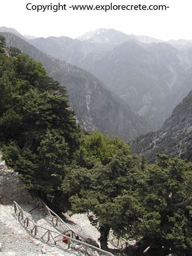
The descent into the gorge begins and we go down the snaking path with the steps. 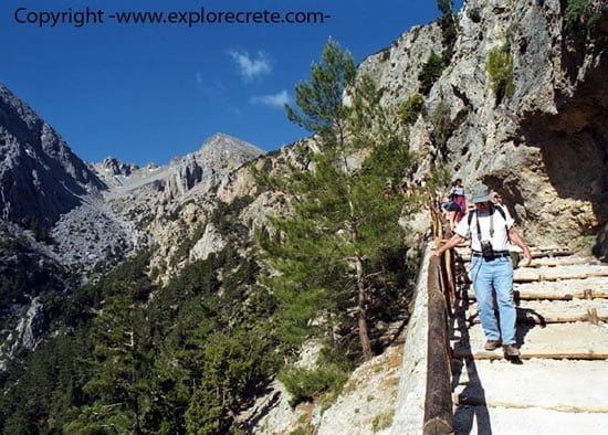
The steps make the descent easier and safer. However, at many points the stones have been worn smooth by constant use, and it’s best to wear appropriate, non-slip shoes that support the foot properly. 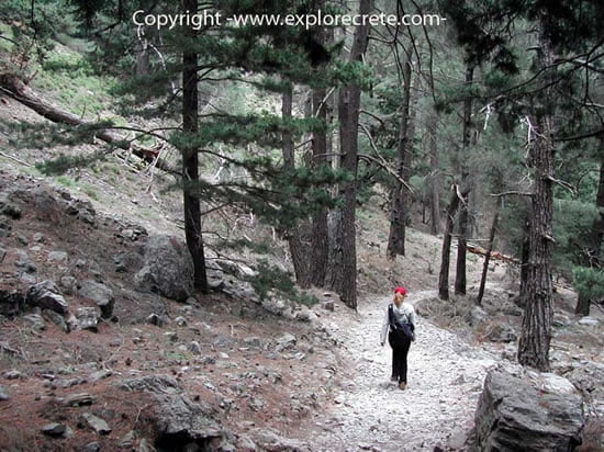
The first few kilometres down the gorge are pleasant, in the shade of tall pines and cypresses. 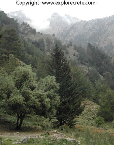
Samaria is green and totally unlike the arid, desert landscapes of southeast Crete. The images in Samaria are like a journey many centuries back in time, when the whole of Crete was covered in tall trees. 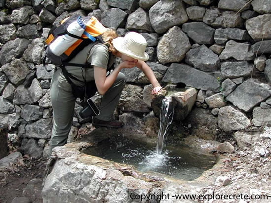
All along the route are springs with cold, clear drinking water, so you don’t need to carry too much with you. A small bottle which you can refill occasionally is enough. 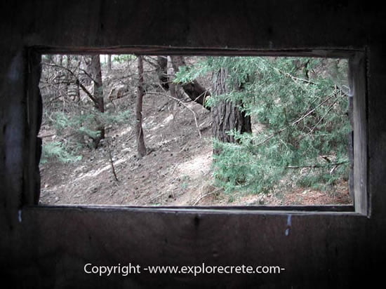
There are also toilets at many points on the route. 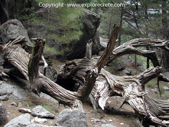
Nature generously provides beautiful pictures which obey no rules. For instance, this dead tree trunk fallen on the ground still has an enchanting shape and texture. 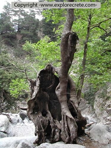
Another unusually beautiful tree. 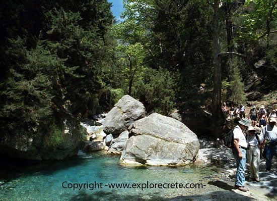
Walking in Samaria you will often see the stream that flows through the gorge. 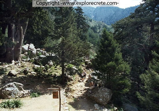
The scenery at Agios Nikolaos, the place where most people make their first stop. 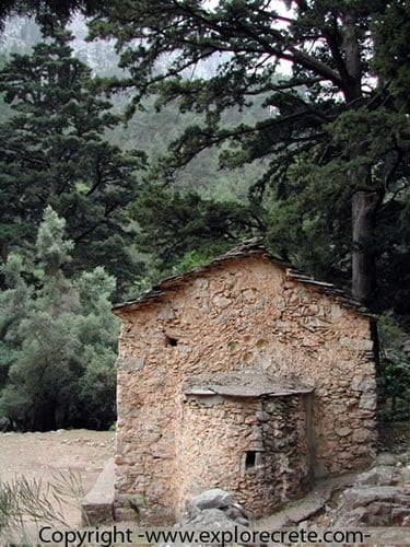
The tiny church of Agios Nikolaos is built on the ruins of an ancient temple of Apollo. It is thought that the ancient city of Kaino stood somewhere in the area. 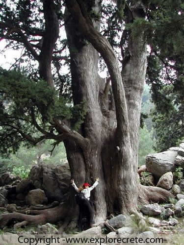
An ancient cypress tree next to Agios Nikolaos. This may be the largest and oldest tree you will see in Samaria, and people look tiny next to it. 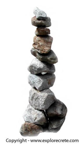
A pile of stones marking the path through the gorge. You will see lots of these along the route. 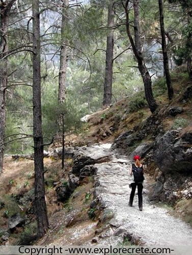
The path continues through the forest. If only all the paths in Crete enjoyed this wonderful shade and the cool, pine-scented air. 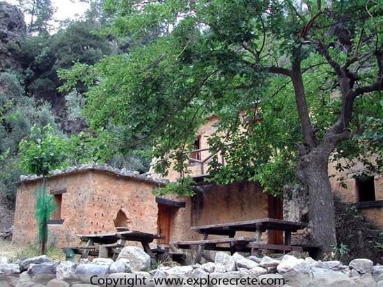
Houses in the village of Samaria, in the heart of the gorge. People lived here for thousands of years but the village was abandoned in 1962, when Samaria was declared a National Park. 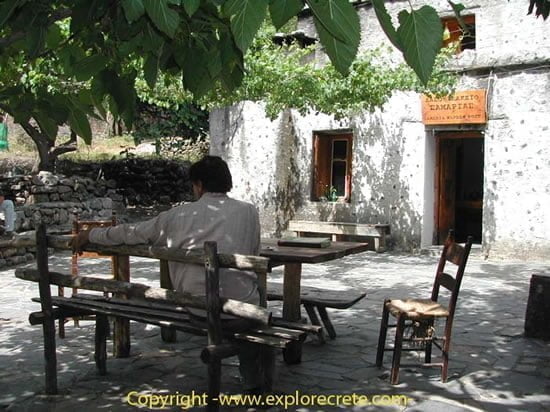
Enjoying a revitalising stop at Samaria village. This is where the park wardens live today. 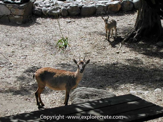
Two small wild goats, the famous “kri-kri”. The ones living here are used to people and you will often see them among the village houses. 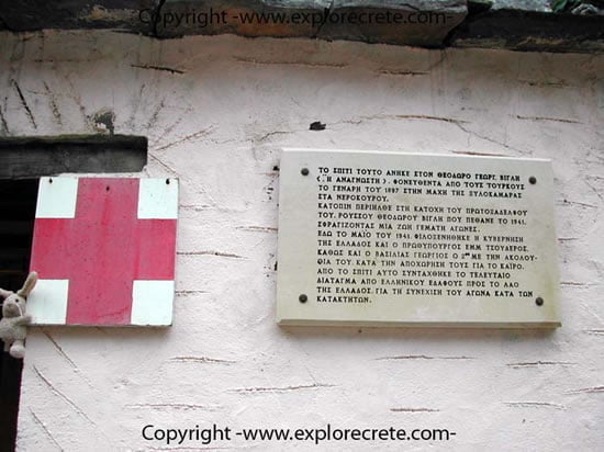
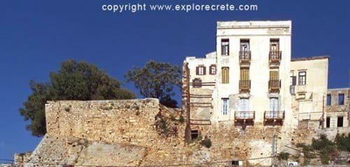
The Samaria surgery is housed in a simple building with a long history. In May 1941 the Greek Government, including Prime Minister Emmanuel Tsouderos and King George II and his retinue, stayed here until they could leave secretly for Egypt. In this house was drawn up the last government decree to the people of Greece issued on Greek soil, calling for the struggle against the German invaders to continue. houses in the gorge 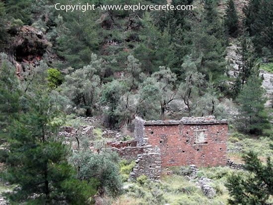
Ruined houses in the gorge. 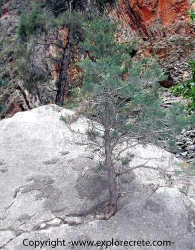
The amazing power of nature: a tree growing on solid rock. 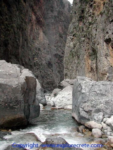
After the village comes the end of the long descent from Xyloskalo. From here on the path is less steep but the walls start to close in and you get the definite impression that you are indeed in the largest gorge in Europe 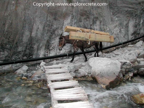
Mules are used in Samaria to carry both equipment and people injured on the way (usually sprained ankles), who can’t walk the rest of the route. 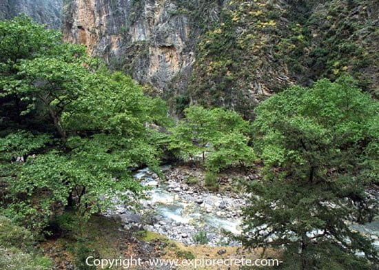
Plane trees grow on the banks of the stream that foams down the gorge, especially in May and early June. If you come in July and August the water level is much lower. 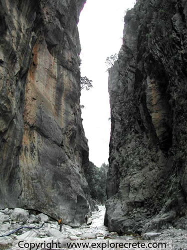
The famous Iron Gates (Sideroportes), the narrowest point of the gorge, only 3 metres wide. 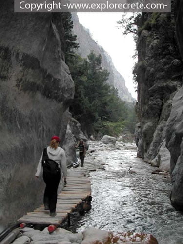
Crossing the little bridge to go through the Iron Gates. 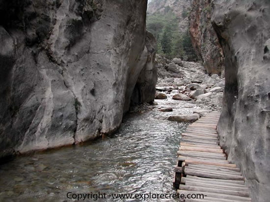
The Iron Gates from the other side. 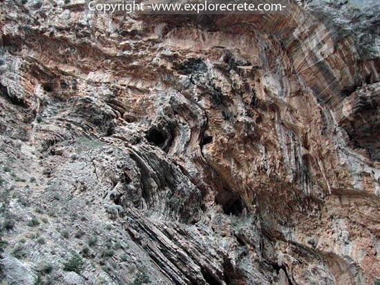
The whole geological history of Crete is imprinted on the rocks of the gorge. 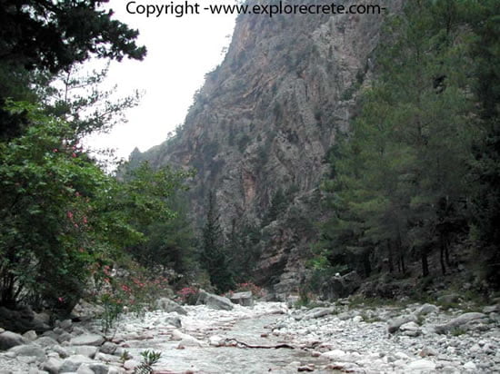
Once we are through the Iron Gates the gorge opens out and the scenery loses its wildness. 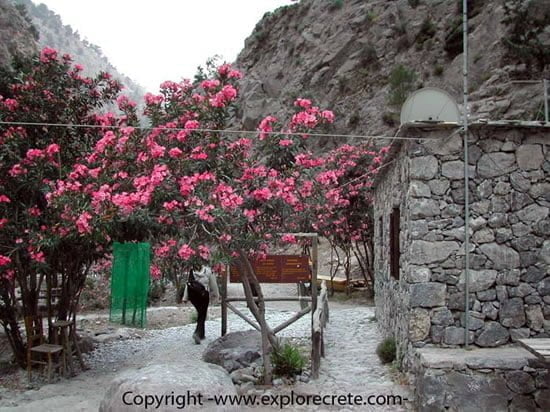
The ticket check for those leaving the gorge marks the end of the Samaria National Park. 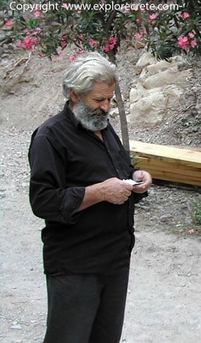
A park warden from Sfakia checks tickets. His black clothing is the characteristic costume of Sfakia men. The ticket check is to ensure that nobody has stayed behind in the gorge, either on purpose or due to an accident. 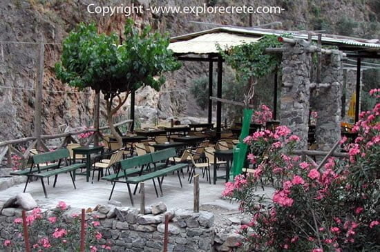
Next to the ticket control point are snack bars offering soft drinks and juice. 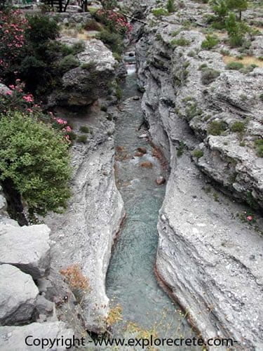
It was water that carved the Samaria Gorge, dissolving the limestone rocks. The gorge still gets deeper year by year, as you can see at this point, where a smaller gorge is being formed inside the older and larger one. 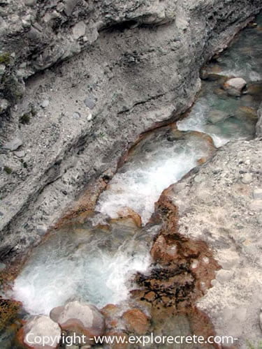
The foaming water rushes ceaselessly through, dissolving the rocks in its path. 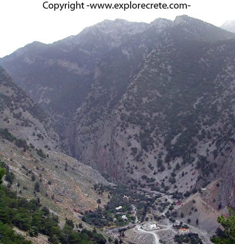
The exit from the Samaria Gorge seen from on high, from the fortress above Agia Roumeli. 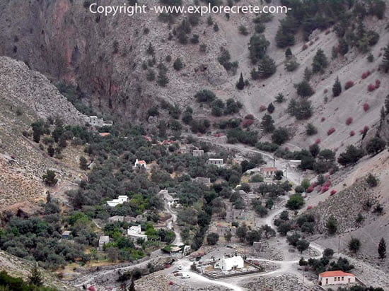
Another shot of the area at the exit from the gorge. Agia Roumeli, the end of the route, is only a short distance away. 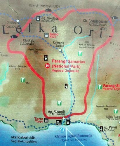
A map showing the Samaria Gorge from Xyloskalo, high in the White Mountains, down to Agia Roumeli. The total length of the gorge is 18 kilometres, 15 of them inside the National Park. It should take you about 6 hours’ gentle walk to cover the whole route. This will give the chance to enjoy Samaria without rushing. Remember that there are lots of gorges in Crete, but only on Samaria have the locals bestowed the honorary title of “Farangas”, “Great Gorge”, in recognition of its unique beauty and majesty.
- Read more about Samaria Gorge
© explorecrete.com All Rights Reserved. Reproduction or copying without permission is prohibited.