Lassithi Plateau
Lassithi Plateau is one of the few areas in the Mediterranean with permanent inhabitants at an altitude over 800 metres.
Lassithi plateau is 11 kilometres on the east-west axis and 6 kilometres on the north-south – an area of 25 square kilometres.
Have your camera loaded as there are many photo opportunities, especially early in the morning and in late afternoon.
Dikteon Andron, the cave where Zeus was born, is located here, but have shoes with a good grip with you, as the stairs leading down to the cave are quite slippery.
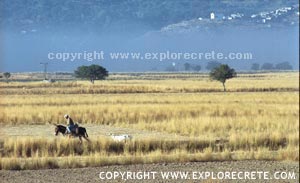
There are many small villages on the plateau which maintain their traditional colour and character. Don’t hesitate to come out of your car and walk along the little streets. You will be rewarded with nostalgic sights of authentic farm living.
Reading most tourist guides about the area, you are sure to see it described as a plateau of 10,000 windmills. There are also some old black and white photos showing thousands of windmills scattered throughout the area. Unfortunately, most of these windmills, with crude pumping engines and iron towers of simple technology, no longer exist.
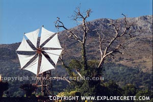
Originally, the locally-constructed windmills made their appearance in the valley at the end of the 1800s. During the 1950s there were about 4,000 of the structures offering invaluable assistance to local farmers. Today, with more modern means of irrigation and power supply, that number has been greatly reduced, depriving Lassithi of its unique identity.
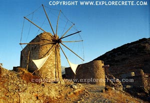
However, there is much renewed interest in the restoration of the windmills, which would bring back the picture of the Lassithi Plateau as it once was.
Exiting the Lassithi Plateau and heading towards Heraklion, there’s an area just before the village of Kera where 24 stone flour mills dating back to the 1800s once stood. They operated until the end of WWII, but today most are in various stages of ruin, with only three restored so far.
Just beyond this area is the Kera Monastery, famous for its beautiful frescoes. Anyway, they’re both worth a look-see if you have the time. And, if you’re hungry, you’ll have to try Mrs. Marazaki’s classic Cretan omelette, a tradition in its own right, at her family’s taverna in Kera village.
© explorecrete.com All Rights Reserved. Reproduction or copying without permission is prohibited.